Showing posts with label My Caches. Show all posts

Friday, May 6, 2011

Szuchie's Sense of Serenity...

At some point during work today I had the brilliant idea to go for a hike once I set free for the weekend.  Normally that's a standard occurrence - only this time this genius notion was accompanied by an agenda and everything.  I was surprised as anyone, because my ideas never come with an agenda attached.  It's like my brain just gave itself a gift or something...what a bizarre and strangely psychotic concept.

The back story on this idea and agenda (because most everything comes with a 25- page dissertation that could easily be boiled down to one or two sentences) was a combination of two things.  Both involved caches...shocking right?

Part numero uno of my plan was to head to a section Wyoming County public forest and re-find the final for The Tranquil Trickle of Trout Brook by Snowman257.  This is a cleverly done 5 park multi that requires you to bushwhack through a the woods alongside Trout Brook.  Some parts are a swampy mess with wall to wall thorns, prickers and other undesirables...but for all that, there is also nice open woods and other cools spots.  Chicky and I had found this cache back in 2010 when I was going through a non-logging phase.  So basically I had found the cache, but didn't bother to log my adventure online...which in turn meant that I had no clue when I actually had found this cache.  I could have made an educated guess (and probably would have been right on in hindsight), but instead decided to revisit the final to find out when I had originally logged in, so that I could log online since at this brief point in my life I've decided I'm happy doing that again.  My life is one big whim people, it's horrible

The section of WyCo forest is actually split into two parts by Hobday Road in the hamlet of Hermitage which is located in the Town of Wethersfield (I think...haha).  The side of the woods that Tranquil Trickle of Trout Brook is located on is not developed.  Of course that will change soon, as the County has decided to forest this side of the road...which is understandable, but also pretty lame.  But hey, in like 2 or 3 years there will be an access trail for people to place millions and millions of caches along (eye roll).  Anyway...to do anything over there requires your big boy pants and a pair of good muck boots.  It's swampy, and with all the rain we've gotten the will certainly come in uber handy.  I headed into the woods, and after crossing Trout Creek I made quick work of the cache.  I checked the log book...and well...you get the idea...

Clearly I was enamored with this one...haha.

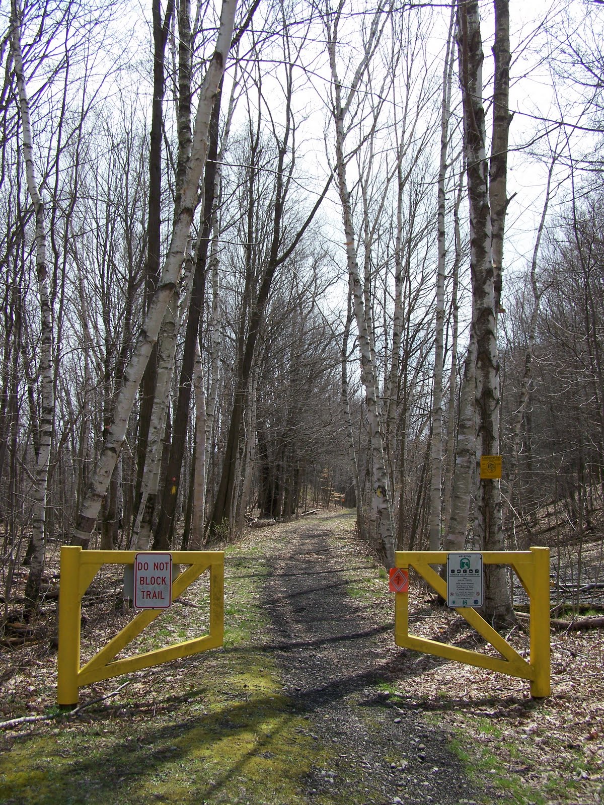
With that stage of my trek under wraps, I began the second portion of my journey.  This would be to cross Hobday Road into the other side of WyCo woods.  Here there is a dandy trail - and along this trail is a three-part cache called Szuchie's Sense of Serenity by every one's favorite cache blogger - Me!  Since I hadn't paid a visit here in a little while, I deduced that it would be the perfect opportunity to enjoy this 2-mile round trip hike and in doing so run through part of this cache.  I wasn't 500 feet into my hike before I was greeted by the beautiful colors of spring.


Aww...pretty right?  Not long after this blossoming babe, I arrived at the first stage of my cache.  This was a letterbox stage that required you to follow a couple clues to find the first leg.  What I love about this spot, was that at some point in history someone planted a ton of spruce all lined in rows.  So you enter this patch of woods and it's very dark and spooky.  Really cool stuff though as you can see how all the trees line up almost perfectly with one another.  So of course it needed to be shown off - and hence the first stage of my hike.  From there it was a gradual uphill hike where this trail "T"'d with the snowmobile trail that ran west to east.  Just a short jaunt west and you'd arrive at a really unique spot, that if you weren't pay attention you'd probably not notice.


While it's hard to tell from just this picture...that is the foundation to an old log cabin structure.  I don't imagine that they ever built a house, however it's a really neat thing to find in the middle of the woods.  The second leg was within 10 feet of the "front door" as I couldn't help but show this strange phenomenon off to geo-visitors.  From there, I headed east to the last stage of my cache.  This was the longest portion of the hike - and the closer you got to the final, the more beautiful and open these woods became. 


I arrived near the final and made an unfortunate discovery.  Since the County plans on harvesting timber on the other side of the forest, they must have hired some surveyors or something to mark the boundaries of these woods.  When I first placed this cache, I believed the final was just on the right side of the boundary line...sadly I was off by about 75 feet or so...which meant that my final cache had to be moved.  It was a tough decision, because the final cache was in an awesome spot, and that particular section of open hardwoods and nearby creeks was stellar.  Plus, the hiding spot for the cache was an awesome old cherry tree - check this out!


Sigh...so after a few minutes of deliberation, I decided that instead of trying to make this work, I would just archive the cache.  The cache sort of came together and to modify it would just take away totally from what I was trying to accomplish - so it made sense to me.  It'd be like taking the Mona Lisa and removing her famous the smile.  Sure it would still be a good painting, but it just wouldn't be the same.  Now imagine that in the form of a crappy cache that da Vinci wouldn't touch with a 20 foot pole.  Haha.  With the cache dangling in my hand, I began the slow, somber hike back out.  One of the last picture I took before I left, was this...which I'm pretty sure is one of the reasons I always try and place caches like this.


I was grateful to have placed this cache, and moreso for the people who took the time to find it.  While I'm sad to see it go, maybe someone will place something that once again shows off this exceptional section of hardwoods.  What a wild and weird Friday night!

Sunday, April 24, 2011

My new cache: A fun little update 'cause I'm a dork.

After P-Man and BFG accidentially did one mile of additional "not on the original agenda hiking" in the wrong direction, they were finally able to get themselves turned around and I'm glad to report they found the cache (which what sounds like no additional complications...haha).

For those curious, here is P-Man's log (with pictures) and also ButterflyGuy's!

Congratulations on completing this adventure, even after doing an additional (and unexpected) mile on trails that I know where really wet and muddy!

The Great Letchworth Adventure!

Last weekend I finished my cache (AKA: The Hike) in Letchworth State Park - and once it was all set in place I decided to let it cure until the following Friday.  I was really happy when it went live.  It's been a while coming, but it was finally out in the cosmos for mass consumption.  So knowing that there might be people looking to find this shiny new adventure, Chicky and I decided to spend the day caching/hiking in the park.  There are a few caches I wanted to work on, and at the same time I thought it would be neat to loiter in the area and see who might be brave enough to tackle this one. 

The morning started off a little precarious, as WNY was getting hammered with monsoon like rains.  Reports indicated that the storms would move out of the area by mid-morning, so we decided to start the morning off by snagging a little breakfast at the Eagle Inn, located in the cow-filled metropolis of Eagle, New York.  Haha.  From there we watched the rain pour and pour, but it must have been Mother Nature's last hurrah, because after that the hardest of the rain let up.

From there we were free to travel to Letchworth under cloudy and mostly dry skies.  The first stop was to cruise by the parking locations for my cache.  The Hike recommends parking in two different locations, one to start your journey and one to end your journey (there's about 2.5 miles of road between the start and end points of the cache).  Anyway, there were a few cars littered about on this side of the park - in what would turn out to be hunters actually (I have no clue what season is open right now...probably something bizarre). 

None of the vehicles looked familiar, so we headed into the park to start a cache called 20,000 Meters Under the Cache by MysterySolvers6.  I wish I could tell you what that means...but all I can figure is it's a play on words, from 20,000 Leagues Under the Sea by french novelist Jules Verne (who in his Wiki picture looks like a happy fella).  As far as I know, whales are not indigenous to mainland Western New York, and I'm pretty sure park management would be awful sore if you went tearing along the Genesee River in a submarine.  Not that I wouldn't consider it.  But I digress...

The cache is a 5-part multi, so it takes you to many different spots on your way to your final destination.  With the sun started to finally peek through the clouds, we parked near the first stage at Inspiration Point and started our journey.  While Chicky looked for the cache, I took pictures. 
 

Pretty sweet huh?

From there we made several other stops in order to complete the necessary requirements and find the final cache.  Because I don't want to give all the fun away, I will just shut up and post a few pictures for you to oooh and aww over.

The flowers are starting to bloom - yay!

The Lower Falls were raging really hard today.

Heading back down the trail.

No worries, there's like 18 more miles to go.  Haha.
In the end we got in a few miles of beautiful trail and scenery - in many places I haven't visited in years.  The longer we hiked, the nicer the day got.  By early afternoon, the sun was out and there were beautiful blue skies. This was the perfect day to be in Letchworth! 

At some point in the morning, while in between legs, we got a call from Paleoman and Butterflyguy.  They were working on my new cache!  I was pretty excited to hear from them, until they told me they had made a wrong turn somewhere.  After trying to figure out where exactly they were, we determined they had overshot a turn in the trail and were going to have to backtrack.  To provide a little guidance, Chicky and I headed over to the other side of the park and quickly made our way down the Bear Meadow access trail to where it met with the Finger Lakes Trail.  Just as we were approaching, I saw them crossing a gully just ahead.  I shouted out to them, and soon we were chatting about their already thrilling morning adventure!  After making sure they had all the necessary information, we parted ways - us back to the truck and them on to the rest of my cache.  I was pretty excited that there were people tackling it, even on a day as wet and muddy as this. 

Please someone might very well find the cache today, Chicky and I returned to our own caching adventure.  On our way back to conclude 20,000 Meters Under the Cache we made a pit stop at the Parade Grounds in Letchworth to find another cache I had started previously called Civil War Connections in LSP by Dehgewanus.  This is a puzzle/multi that explores the wealth of Civil War-related history that is present in the park.  Again, I don't want to give too much away - so here we go with a few pictures!!!

A biggun under the blue skies!

Chicky holding up the prize loud and proud!

Heading down the FLT under the sun - that's the way we rolllllllll.
After we were done playing on this particular section of FLT we went on to complete the rest of our geo-adventures - which actually required us to take a circuitous route to one leg where we ran into more cachers!  This time Howie and Jan were driving down the park road on the east side of the park - and happened to see us returning back to our truck.  It was really nice seeing them, and after chatting for a bit about the "geo-scene" we went our separate ways.  

Chicky and I eventually ended our day in Letchworth.  We had a blast playing in the park today, especially with the added bonus of seeing so many familiar friendly faces.  To celebrate the great hikes, good caches and fun times, we hit Carneys Market in Castile, NY for pizza slices and drinks.  It was delicious - and the perfect way to round out this Saturday outside.  In total, I ended up driving well over 100 miles in and around Letchworth - seeing so many beautiful sights.  I love this place - and I can't wait to return!

Saturday, April 16, 2011

My Great Letchworth Geo-Adventure Nears Completion!

After a couple grueling weeks at work, I decided to take yesterday off.  I had to.  I have been a messy stressed out wreck, and I'm pretty sure that a respite was necessary before I threw my miserable self off the deep end.  To soothe the savage beast, I decided to visit Letchworth and pay everyone's favorite Park Manager Mr. Beck a visit.  You see, in order to get a cache published in the park, you have to get Mr. Beck's approval. 

I couldn't sleep the night before, so I was actually up ridiculously early.  So I putzed around a little, and hit the pavement a little after 7am.  It was going to be an awesome day out, as the air was cool and the sun was shining brightly.  There wasn't nary a cloud in the sky, and I was on my way to hopefully secure the linchpin in my LSP geo-plans.  Mr. Beck is a really busy dude, so getting time with him can be hard to do.  Lucky for me, he was available today to chat - so when the cosmos opens a window, you jump through the damn thing.

I had told Mr. Beck my arrival time would be somewhere in the 8 to 8:30am timeslot - so when I got to the park 15 minutes early, I decided to take a walk and check out one of the caches in the park that has been giving folks fits.  The cache is called Steps by Brogan.  The name don't lie - there are a lot of "rustic steps" starting from underneath the train trestle down into the gorge hill above the Upper Falls (check it, I linked to one of my waymarks...oh yeah, hecka nerdy y'all!!!)

For some reason my left knee was really pissed and trudging up and down those stairs.  But I did.  The mist from the falls sparkled in the morning sun, and once in a while it'd kiss my cheek.  It was cold, but it made me smile - which was much needed.  For a bit I wandered up and down the stairs looking for the cache.  I didn't have my GPS with me, but still...there are only so many places to look right?  Haha.  Either way, I had no luck.  Eventually I decided it was time to go see Mr. Beck - so back to the truck I went. 

In September 2006, I placed a cache in Letchworth.  It was my first cache placement here, so after meeting Mr. Beck, he hiked the 3-plus miles roundtrip to check out my cache.  Since I was new to him, he wanted to make sure the cache conformed to the park's policies, that it wasn't dangerous, and that I wasn't doing something stupid.  He was a trooper, because when he made that hike he was still getting over a really bad chest/head cold.  Poor fella!  He liked that cache, and so he approved. 

This time around, I didn't think he would make the trek, just because this time around it would be an 8-plus mile hike, and at this point I think only I would be dumb enough to want to do that.  So, my hope was he'd let me explain what I was doing, and if he like what he heard he'd give me the green-light.  I walked into Letchworth's main office building feeling a little nervous.  Mr. Beck is the Park Manager, so if he didn't like it...then I was sunk.  He's the boss after all!

Thank you Mr. Beck!!!
He came out into the lobby to get me, and was really friendly.  I've always like Mr. Beck...and as I sat down in his office we got down to business.  I explained to him the layout of my cache, as well as all my other crackpot Szuchie ideas for this hide.  He seemed really cool with it all, and with that I was approved! 

Sweeeeeeeeeeeeet.

Now that I had permission to run amuck in the LSP wilderness hiding caches, I had to actually finalize a spot for my final cache.  Haha...I know that sounds backwards, but I swear the logic is sound.  Why get the cache all placed and done, and then go and have it denied?  Brilliant right?!?  Haha.  Truth of the matter is, the entire cache is going to be three legs.  The first two are set - and the final was pending some exploration (don't worry faithful readers, Mr. Beck knows about my plan and when I have everything finalized, I'm going to email him with all the details). 

After this huge triumph, I headed to Castile, NY to meet Brogan and dine at Lorraine's Place.  I got french toast.  Nom nom nom!  Afterwards we headed back to LSP.  He wanted Mr. Beck to approve his re-furbished Steps cache, and I wanted to pick up an Empire Passport which I had forgot in all the excitement earlier.  The passport gets me into all NY State Parks without having to pay the admission fee (where applicable).  At 8 bucks a pop, it's a sound investment.  Especially for as much as I go to LSP.  Anyway, Brogan and I spent a few hours screwing around, and eventually we departed company.  I made my way to Perry, NY to enjoy some lunch at John and Sarah's Family Restaurant with Chicky.  I had a chicken finger wrap.  Revenge of the nom nom nom!  For desert, it was off to The Charcoal Corral for my first twist softserve of the year.  Even more nom nom nom!

With lunch done, Chicky returned back to work and I returned back to LSP.  This time I rounded the park through Portageville, and headed to the east side of the park to work on finding the perfect location for the last part of my cache.  I arrived at the Sycamore Trail access to the FLT, and saw a familiar looking vehicle parked in my spot!  It was Paleoman52!  I headed down the trail hoping to run into him.  I arrived at the intersection of the FLT with no one in sight.  Bummer dude.  I suspected he had continued down the Sycamore Trail towards the gorge and his cache The Old Man of the Genesee.  The cache describes a Sycamore tree (namesake of the trail) that lives along the banks of the Genesee River.  It's one of the older trees in the park, and is also a record holder I believe for it's massive size and age.  If you want to see this epic giant, get there soon though, because the river is undermining it's base...sadly it's just a matter of time.
 
Check out my sweet can.  Camo courtesy of Cayuga Crew!
Since I wanted to get a jump on my own cache, I waved in the general direction of P-Man and started down the FLT.  It was considerable more mucky today than it was the last time I was here.  But it was still beautiful, and really...nothing could dampen my spirits.  After a mile and change, I started looking for a good spot for my ammo can.  I really wanted to hide a 50 caliber ammo box - which for those not familiar is a mid-sized box.  The smaller version is a 30 caliber - and while that was an option, I figured a larger box would be a nice treat for someone who completes this cache. 

For whatever reason, I just couldn't find a good stop.  I was actually getting frustrated, because the other two legs found me pretty easy.  After one or two spots let me down, I found a decent spot for the final.  It's not far from the trail, and had a nice view of hardwoods (as far as the eye can see!)  It wasn't ideal, but it would work so...I'm happy with it.  For a while I tried to get a good coordinate reading, but my GPS was copping serious 'tude.  I think the ones I ended up with are legit - we'll see!  After I was done, I explored a bit as there was an old farmers dump in the direction of the gorge.  The day started getting late, so I headed back to the FLT and made my way slowly back to the truck.  I was tired, but felt like I accomplished a lot!  Here's hoping the weather is nice Sunday, as I might be able to finish the cache - and then I can make it open for public consumption!  :-)

Sunday, April 10, 2011

My second bloggable Letchworth hike!

A few weeks ago I started mapping out a cache along the Finger Lakes Trail (FLT) in Letchworth State Park.  Weekends have been a bit crazy since that time, but the plan today was to once again return to explore and hopefully get myself closer to having a legitimate cache placed!

The last time I was here, I parked at the Sycamore Trail and headed north.  This time I would jump off at Bear Hollow and hike south.  My goal was to explore a spur trail that jutted off the FLT and headed to an overlook of the Genesee River gorge that is referred to by the FLT Organization as Fiddler's Elbow.  To say I was really excited might have been a little overblown, as my body didn't seem all that thrilled to tackle a multi-mile hike in the up-and-down land of Letchworth - but my brain insisted (which as I sit here and type now, I'm thankful for even though my legs are a smidgen pissed.  Haha). 

I hit the trail around 11am or so, and quickly found that Bear Hollow was more a mushy sloppy soaking wet mess, than it was a legitimate access trail.  I probably wasn't more than 1,000 feet from my car before I got a muddy soaker...but I suppose at that point, it's best to get it out of the way.  Besides, I'm a hiker right?  Water and mud are all part and parcel.  So anyway, I enjoyed the muddy slide downhill towards the FLT.  After about a fourth of a mile, I arrived and joyfully marked the intersection in my GPS.  The reason I was taking such meticulous notes, is that when I place this cache, I want to make sure I give everyone explicit directions.  Some knuckleheads like to bushwhack from spot to spot - but on this side of LSP that will probably get you killed.  There are ravines after bloody ravines running east to west as the FLT runs north/south.  Basically, if you leave the trail and try and make your own way, you might not be found. 

I took a deep breath, and made a left turn onto the FLT - heading west towards the overlook listed on the Park's map.  I had hiked this section of FLT years ago, but at that time we were more interesting in distance then sightseeing - so this would be my first time checking out this particular overlook.  According to maps, it looked like the spur trail would take me a little over a third of a mile off the FLT - right at the Genesee River Gorge.  So I expected pretty big things baby...pretty big things indeed!

The hike was really enjoyable, even though it took a little while to find a good hiking rhythm.  A couple times I probably could have just stopped and reaccessed my desire to press on - but I was here - and I couldn't turn back.  The farther I hiked, the happier I became with my decision to do this today.  I was maybe a mile or so in, when a woman in a sports bra and spandex came down the trail in my direction.  I was a little baffled, especially seeing as the next access point was probably a good four-plus miles away.  I bade her good morning (some what quizzically) as she huffed on by.  She would be the first of many runners I'd run into today...so there must have been some kind of race and/or training going on.  Deep woods running - what an interesting concept...not for me though...I'm far too pokey and I'd never win anything as long as I was checking out all the scenery like the nerd I am.

After almost two miles of hiking, I started to get a little concerned that I had missed my spur trail.  Where was this damn thing?  I figured I'd press on though, as I knew if I hit a ravine (unto which the FLT would circumvent), I had gone too far.  Thankfully, the lingering paranoia was short lived, because as I crested yet another hill, I saw the beautiful blue blazes marking my special little trail.  From there it was all downhill.  My legs liked that after the up and down I had being doing for a couple miles, but my head knew all too well that what goes down must come up.  Haha. 

The Genny peeking through the trees!

The woods down here are beautiful, and I was again smiled knowing I did the right thing.  Because hey, I was almost halfway done with my hike!  All downhill after that...metaphorically speaking.  ;-)  As I approached the end of the trail I started to notice the Genesee River through the oaks and hemlocks.  It was really pretty - and as I arrived at the end of the trail, the overlook was exceptional - just like I had hoped it would be. 

I unloaded my gear, and started looking for a good spot to place a cache leg.  At first nothing struck me, but after one loop around I found a lovely oak tree near the overlook that will work perfectly for what I want to do!  I love that mother nature is cooperating with me on this cache thus far...she must want me to show off these awesome spots as much as I do.

At this point I decided to relax a little as I genuinely felt like I had successfully accomplished what I had set out to do.  So I grabbed my camera and started taking a few pictures of the overlook.  Now was probably the best time to get a glimpse of this - as once the leaves come in I think it will obscure it more.  But I was happy to bask in my discovery, and spent a good 20 minutes enjoying the peace and serenity this location afforded me.

Yay for pretty overlooks!

Eventually my mind turned to the trip out - so I enjoyed some high-quality H2O, packed my stuff back up, and began the trek uphill.  I did stop briefly at one point to look back.  With a satisfied smirk on my face, I knew I'd be returning here (hopefully sooner than later) to finish my geo-opus.  Hahaha. 

In retrospect, the trek back wasn't too bad at all.  My left knee was a bit of a bugger, but for the most part I kept a good pace, stopping from time to time to let more oddly dressed runners pass me by, sometimes scaring them as they probably didn't expect to see me leaning up against a tree as they went chugging by.  One girl almost screamed.  Hehe...and yes, I'm proud of that.  Clearly my burliness is awful damn scary.

On my way in a I passed one particular spot by that I knew I wanted to take a picture of on my way back.  I vowed I would, no matter how tired I might be.  It was a little creek, and someone went and built a pretty sturdy stick bridge over it.  It made me wonder why there weren't more (probably because they were ambitious with this one, but once they realized there were like 700 spots exactly like it, they said 'to hell' with it.  Every hiker for themselves!)

Only 700 more to go....suckers!

So here it is, in all it's glory, the little stick bridge that I thought was so unique, it warrented a pit stop/photo opp!

In total my stocky little tookis covered probably 4.5 miles in LSP today.  It was a good day - but it's started getting me to ponder how long a hike this cache will be when it's all said and done.  How long is too long?  And to be fair, while my last two visits were piece-mealing legs together, I will be hiking the full cache hide when I've got everything ready. 

So if I can do it, I figure the majority of the population can!

Thursday, March 24, 2011

My first bloggable Letchworth hike!

My adventures on Sunday 3/20/2011:  You just plum could not find a better day to be outside hiking then this day. The temperature planned on hovering in the mid to upper 40’s, the sun was out all beautiful and bright, and the snow was nearly impossible to find anywhere along the Finger Lakes Trail in Letchworth State Park.

The day before I had headed to Leicester to play along the Greenway Trail. To get there, I took the round-about route down through Portageville, hugging the east side of the park as I made my way north. The purpose of this was to do a little reconnaissance and ascertain how much snow might be tucked away in these woods. As I drove, I didn’t see hardly any snow – and with that – the deciding factor was set in place – Sunday would be a hiking day in Letchworth along the Finger Lakes Trail.

This might be a little biased… and since it’s my blog you’re bound to run in to a little of that… but I think Letchworth State Park is one of the jewels of the New York State Park system. Almost every NYS Park I’ve visited is awesome for a variety of reasons – but Letchworth is something otherworldly. It’s called the “Grand Canyon of the East,” as the Genesee River has created a 17-mile long gorge with multiple waterfalls and in some places cliffs that are 600 feet high. Every spot in the park will leave you drooling in awe – it’s that awesome. Besides all that jazz, the Finger Lakes Trail (FLT) also runs along the east side of the Park. It clocks in at about 24 miles of deep woods hiking goodness. The thing I should also mention is that the east side of the park is the “wild side.” It’s not very developed; there aren’t many roads or man-mad facilities to be found. The west side is the touristy side, and the east…that’s more for the hikers baby!

Anyway, the plan today was to spend a few hours hiking the FLT to go to a spot I had never been before. On Letchworth maps, it is only classified as a blue side trail off the FLT. However, the folks from the Finger Lakes Trail Conference call this dandy spot Owl Forks Ravine. It’s a bizarre physical feature when you look at it with topography maps. Here you’ll find a thin ridge that runs parallel with the Genesee River –with a ravine running along the other side eventually cutting a fine point at the end of the ridge where it dumps into the River. Bizarre stuff – and I was curious to see it for myself. What furthered my interest was that the shortest route to and from this ridge involved a six-mile roundtrip hike. So if you’re keeping tabs: this spot was awesome, unique and removed. If that isn’t destination worthy right there, I don’t know what is!

The thought of doing a hike in the 5 to 6 mile range was a little daunting. It’s been a long winter and I’m not exactly in prime hiking shape. I figured this would be a good chance to see what I was capable of doing. The experiment began a little after 9am as I started down the Sycamore Hiking Trail – an access to the FLT that runs perpendicular through it and meanders down into the gorge where you’ll find a massive Sycamore that’s a few hundred years old (and I believe is one of the larger Sycamores in NYS). It’s a super awesome tree, and anyone lucky enough to have the chance to make the trip should before it’s gone. Word on the street is that the river is undermining it…so it’s only a matter of time...

Anyhoo – the grand total hiking distance from my truck to where the Sycamore Trail met the FLT was just over a third of a mile. I’m a 20th of the way done with my journey! I love measuring hikes in fractions and percentages. It gives me a sense of accomplishment (and towards the end of longer hikes a bit of light at the end of the tunnel…haha). Here’s a picture of what miniscule progress looks like:

 
I threw on my pack, marked this particular intersection in the GPS, adjusted my stylish circa-2001 visor and took the first step along the FLT. It was a big step, seeing as I hadn’t done much of what I consider long distance hiking since…well since I couldn’t remember. The early going was good, and then I hit my first hill.
If you look at the trail maps for the FLT, you’ll notice some sections of the trail (like the one I was on) are very curvy and bumpy. Sort of like a sound wave – with noticeable peaks and valleys. This is due to the fact that there is a myriad of tributaries cutting through the trail as they head downhill towards the Genesee River. Usually as your going to the brink of a curve you’re going to be crossing one of these tributaries - and as such it’s an uphill jaunt to get to the creek crossing. The first one was mild (they usually are), but it was still enough to get me huffing and puffing and wondering if I was making the right decision. I questioned my bodies ability to cart my large frame such distances, but I figured I’d go as far as I could go - damn the consequences.

The first ravine was behind me, and from there it was downhill. It was then that I was really happy about my decision to hike today. Then I started to think about the cache I wanted to place here so I could share this tract of land with fellow geocachers. Then I started to think about what I wanted the cache to be called, and finally, who I should dedicate it to. I thought about my Dad. I thought about Chicky. I thought about Cayuga. I even thought about the Green Tortuga and Sam Gardner. It was my Dad though, that I thought about the most. I miss him a lot, and I hoped he was watching me. It’s been hard…the last two years. I think he would have been glad to know I was hiking, smiling and enjoying myself…it seems like it’s been years since I could say that and really be confident about it. That’s all I’ll say about that...for now.

I was happy - and the farther I went, and the more ground I covered - the happier I became. I started seeing so many beautiful sights…things I hadn’t seen in years. It was a special day to be on the FLT. It was a good day to be me.


After nearly three miles, I arrived at the side trail to Owl Forks Ravine. I was a little surprised to feel this good. But in my head I realized that I hadn’t even crossed the halfway point of my journey - so I wasn’t about to bust out the “bubbly” just yet. The Finger Lakes Trail is blazed in yellow, while the side trails are blazed in blue. So up hill along the blazed blue trail I went! At the time I wasn’t really sure how long this trail would be before it dead-ends - but all told it would turn out to be about a .40 mile walk. This spot was even more impressive then I could have imagined. I found myself hiking a pseudo-knife ridge all the way to the point - where I discovered breathtaking sights!


I just couldn’t get enough of my discovery - and while I knew others had been there before me - I fancied myself a true explorer. Blazing a trail to places never before visited…by me at least. ;-) This was the payoff for my now 3-plus mile hike…and after snapping a bunch of pictures, I just sat there, propped up against a hemlock tree. This is what it was all about…


In total I probably spent a good hour there before I packed up and started the long hike back. And it was long…but I managed. I made a few more stops to rest and hydrate then I did when I hiked in. My pace was noticeably slower and the hills didn’t come as easy either…but I kept a decent gait and after 4.5 hours and 6 miles of hiking I finally arrived back at my truck. I was exhausted, but I felt an inexpressible sense of accomplishment. I’m already looking forward to getting back here - and am even more excited to hopefully lay out a cache to share these exceptional sights with my friends.

Friday, March 18, 2011

A slight tingle of anticipation...

Alright, so tomorrow I'm heading out to fulfill a zero day.  Normal stuff right?  Mostly.  But this particular zero-day hike is centered around the town of Leicester (pronounced Lester...which I don't get...)  This spot was picked strategically because it's on the way to Letchworth State Park (in a round about kinda way).  My intention in doing this, is to inspect how much snow remains in them-thar woods.  The plan is simple...should the snow be minimal to non-existent on the east side of LSP - a Sunday trip might be in order to start work on a geocache that after three years I feel inspired enough to start working on. 

I really want to make this cache happen...because I think if I do it the way I want, it will end up being a 6-plus miler.  Not only will this be a hearty hike, it will be through some beautiful woods that I love.  While I'm not sure I'm in hiking shape to do all the 6 miles just yet...I want to start wandering around to see what I can see. 

So THIS GUY is pretty excited at the moment.  Updates on my discovery tomorrow!